
(4/25)
In honour of the Diefenbunker’s 25th anniversary, we continue to highlight 25 artifacts from within our collections. This week, we are featuring an Emergency Measures Organization map. This artifact feature is of particular importance as this week, from May 7 to May 13, is Emergency Preparedness Week 2023 in Canada. This annual event encourages families and communities to take concrete actions to be better prepared in emergency situations. The theme for Emergency Preparedness Week 2023 is “Be Prepared. Know Your Risks.â€
In 1959, the Civil Defence Order was established, creating the Emergency Measures Organization (EMO). The main purpose of the EMO was to carry out emergency planning for the continuity of government across Canada and, in 1962, the government transferred the responsibility of public civil emergency training to the EMO. The Emergency Measures Organization went through multiple title changes throughout the Cold War, later becoming the National Emergency Planning Establishment in 1973, Emergency Planning Canada in 1975, and then Emergency Preparedness Canada that same year. Today, it is known as Public Safety Canada.
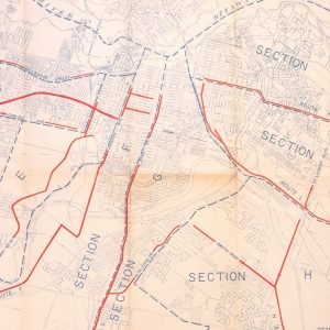
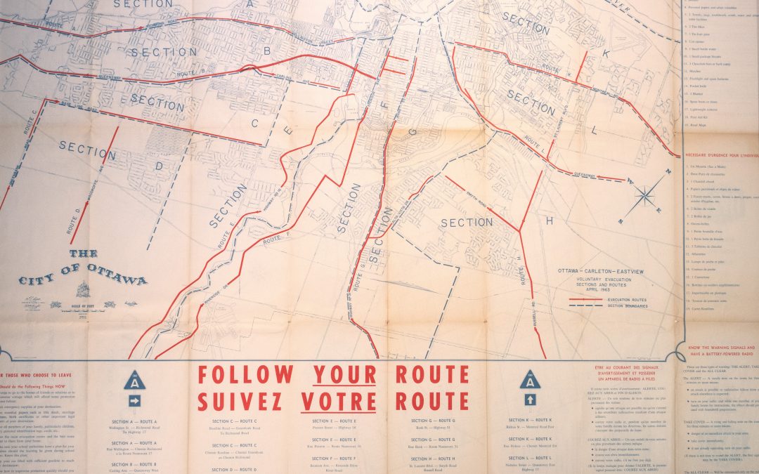
Emergency Measures Organization Map, Diefenbunker Museum: 2012A.001.0321.D
This map was originally published by the Emergency Measures Organization in 1963. Its purpose was to provide information as well as quick and safe evacuation plans for communities across Ottawa and the surrounding area in the event of a nuclear attack during the Cold War. Rectangular in shape and printed on paper, this map outlines the evacuation routes that were to be followed. Ottawa-Carleton-Eastview areas are broken down into sections, each assigned a letter and defined by dotted blue lines. Each section has a designated route to follow in emergency situations, outlined with a red line.
The bottom of the map contains a written route legend. On the right of the map, there is emergency information on what to have in a survival pack and how to distinguish the various air raid siren sound patterns, including the warning signals for “alertâ€, “take coverâ€, and “all clearâ€. These warning signals, as well as the advised actions to take if an enemy attack on North America had been detected, would have also been broadcasted to the public via radio.
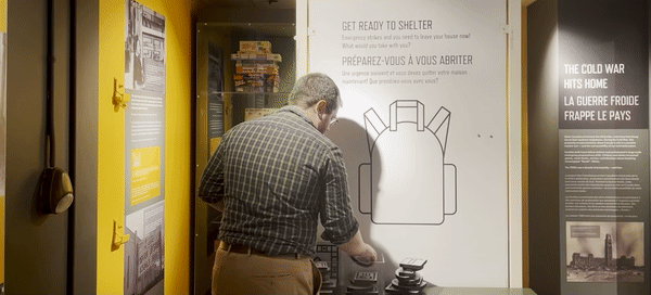
What would you bring with you in the event of an emergency evacuation? Book your visit to the Diefenbunker today and put together your survival pack through an engaging interactive that is part of our new Canada and the Cold War exhibition.Â
Stay tuned as we continue to celebrate our 25th anniversary by uncovering stories from our museum’s collections.